

Using snow patterns to explore wetland drainage
Yesterday we had ideal conditions for exploring the
drainage system in our wetland.
Our wetland contains a cold water stream plus a large
number of springs. Some of the springs flow out only under the cattails or
sedge meadows, whereas others have surface outflows. Our interest was in the
surface ones since in the summer a lot of the springs with surface outflows are
difficult to discern, being hidden by lush vegetation.
Yesterday
the conditions were perfect with bright sun and clear
air. The temperature had dropped in the low teens during the night and at noon
it was still a few degrees below freezing. Most of the wetland was white with
snow, but wherever there was spring water flowing the snow was melted and the
springs were delineated by brown areas.

The geological cross section (courtesy of the Wisconsin Geology and Natural History Survey) shows most of the rock formations at Pleasant Valley Conservancy. Our wetland arises in the Wonewoc formation, which is a modest aquifer. The water itself comes from the sandstone areas above it (Tunnel City and Jordan), and because these formations are so thick, the water source never dries up. (Even during last summer's major drought, the groundwater in our wetland did not change even a fraction.)
Our wetland is riddled with potholes and springs, and because of the constant temperature of the groundwater (about 50 F), there are things flowing all year.
The two dark bands in the photo below indicate two separate springs, the large one flowing west and the small one flowing east.

The photo below shows Kathie standing on the edge of the large spring. The source was at least 4-5 feet deep. Although there is no obvious flow at the source, if you walk a few hundred feet downstream there is a substantial flow.
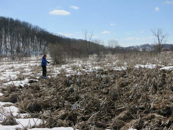
The big pool here is choked with cattails. The air temperature was substantially below freezing and we walked across ice and frozen snow to reach this point.
I examined a number of older air photos with GIS. Although a small creek of the sort we now have can be seen in all these photos, it is not always in the same place. In the 1990 air photo it was shorter but wider and the source seemed to be in a different place. It doesn't seem surprising that these little creeks should move around, because they don't have enough flow to carve substantial banks.
No creek is visible at all in the 1937 air photo, which isn't surprising, since in those days the whole wetland had been tiled.
On the other hand, the main water source, Pleasant Valley Creek, which flows enough to cut a substantial bank, has not changed its course a bit since 1937.
Sandhills cranes have been back for some days now and we were able to get fairly close to one pair.
Sandhills cranes have been back for some days now and we were able to get fairly close to one pair.
0 Comments:
Post a Comment
Subscribe to Post Comments [Atom]
<< Home